- Remaining Timing :-
(1). Koyna Dam located in which state_____________
- (a). Jammu & Kashmir
- (b). Andhra Pradesh
- (c). Maharashtra
- (d). Gujarat
- (e). None of these
Explanation:
The Koyna Dam is the largest dams in Maharashtra, India. Tha Dam is located in Koyana nagar, Satara District, nestled in the Western Ghats on the state highway between Chiplun and Karad. It is 103m high, spread across 881 Sq.km with water storage capacity of 105 TMC. Koyana Dam is rubble-concrete dam build on the Koyna River which rises in Mahabaleshwar, a hill station in Sahyadri mountain ranges. The main purpose of dam is to provide hydroelectricity with some irrigation facilities in neighbouring areas. the koyana dam supply water to Pachhim maharashtra as wel as to hydroelectric power to neighbouring areas. The catchment area dams the Koyna river and forms the Shivajisagar Lake which is approximately 50 km in length. The Koyna hydro-electric project is under the Maharashtra State Electricity Board. Koyana dam is Very beautiful picnic spot. Nehru garden near the Dam is also good place to visit. where one can get all the information about dam and its history.
(2). Rihand Dam located in which state_____________
- (a). Gujarat
- (b). Madhya Pradesh
- (c). Uttar Pradesh
- (d). Andhra Pradesh
- (e). None of these
Explanation:
Rihand Dam is a concrete gravity dam located at Pipri in Sonbhadra District in Uttar Pradesh, India. Its reservoir area is on the border of Madhya pradesh andUttar Pradesh. This reservoir is known as Govind Ballabh Pant Sagar. It is on the Rihand River which is the tributary of the Son River. It is 91.46m high and 932m in length.
(3). Ukai Dam located in which state_____________
- (a). Madhya Pradesh
- (b). Punjab
- (c). Gujarat
- (d). Jammu & Kashmir
- (e). None of these
Explanation:
The Ukai Dam, constructed across the Tapti River, is the largest reservoir in Gujarat. It is also known as Vallabh Sagar. Constructed in 1972, the dam is meant for irrigation, power generation and flood control. Having a catchment area of about 62,255 km2 and a water spread of about 52,000 hectares, its capacity is almost same as that of the Bhakra Nangal Dam. The site is located 94 km from Surat. The dam is an earth-cum-masonry dam. Its embankment wall is 4,927 m long. Its earth dam is 80.77 meters high, whereas the masonry dam is 68.68 meters high. The dam's left bank canal feeds water to an area of 1,522 km2. and its right canal provides water to 2,275 km2 of land.
(4). Indira Sagar Dam located in which state_____________
- (a). Jammu & Kashmir
- (b). Punjab
- (c). Madhya Pradesh
- (d). Gujarat
- (e). None of these
Explanation:
The Indirasagar Dam is a multipurpose project of Madhya Pradesh on the Narmada River at Narmada nagar, Mundi in the Khandwa district of Madhya Pradesh in India. The Project envisages construction of a 92 m high and 653 m long concrete gravity dam. It provides Irrigation in 1,230 square kilometres of land with annual production of 2.7 billion units in the districts of Khandwa and Khargone in Madhya Pradesh and power generation of1,000 MW (8x125 MW) installed capacity.
(5). Uri Dam located in which state_____________
- (a). Rajasthan
- (b). Gujarat
- (c). Jammu & Kashmir
- (d). Kerala
- (e). None of these
Explanation:
Uri Dam is a 480 MW hydroelectric power station on the Jhelum River near Uri in Baramula district of the Jammu and Kashmir region administered by India. It is located very near to the Line of Control, the de facto border between India and Pakistan.It is 176m in length and volume of 120 TCM. The station is largely built under a hill with a 10 km tunnel. It was cofinanced by Sida and was commissioned in 1997.
(6). Tehri Dam located in which state _____________
- (a). Gujarat
- (b). Punjab
- (c). Himachal Pradesh
- (d). Uttarakhand
- (e). None of these
Explanation:
The Tehri Dam of Uttarakhand is the highest dam in India, 2nd highest in Asia and 8th highest in World. It is on the Bhagirathi River near Tehri Garhwal in Uttarakhand, India. Tehri dam is being built by THDC India Ltd. The dam is expected to generate about 2400 megawatts of electricity. The total cost associated with the Tehri Dam project is around Rs 8000/- crores. Tehri dam is about 260.5 metres (855 ft) high rock and earth-fill embankment dam. Its length is 575 metres (1,886 ft), crest width 20 metres (66 ft), and base width 1,128 metres (3,701 ft). The dam creates a reservoir of 2.6 cubic kilometres (2,100,000 acre•ft) with a surface area of 52 square kilometres (20 sq mt). The installed hydro capacity is 1,000 MW along with an additional 1,000 MW of pumped storage hydroelectricity. The Tehri Dam and the Tehri Pumped Storage Hydroelectric Power Plant are part of the Tehri Dam Hydro power Complex which also includes the 400 MW Koteshwar Dam.
(7). Bhakra Dam located in which state _____________
- (a). Andhra Pradesh
- (b). Himachal Pradesh
- (c). Madhya Pradesh
- (d). Kerala
- (e). None of these
Explanation:
Bhakra Dam is a concrete gravity dam across the Sutlej River and is near the border between Punjab and Himachal Pradesh in northern India. The dam, located at a gorge near the (now submerged) upstream Bhakra village in Bilaspur district of Himachal Pradesh, which is about 13 km upstream from Nangal townshi, is Asia's second tallest at 225.55 m (740 ft) high next to the 261m Tehri Dam also in India. The length of the dam (measured from the road above it) is 518.25 m; it is 9.1 m broad. Its reservoir, known as the "Gobind Sagar", stores up to 9.34 billion cubic meters of water, enough to drain the whole of Chandigarh, parts of Haryana, Punjab and Delhi. The 90 km long reservoir created by the Bhakra Dam is spread over an area of 168.35 km2. In terms of storage of water, it withholds the second largest reservoir in India, the first being Indira Sagar dam in Madhya Pradesh with capacity of 12.22 billion cu m.
(8). Idukki arch Dam located in which state _____________
- (a). Gujarat
- (b). Punjab
- (c). Kerala
- (d). Odisha
- (e). None of these
Explanation:
The Idukki Dam, located in Kerala, India, is a 168.91 m (554 ft) tall arch dam is built across river periyar. The dam stands between the two mountains - Kuravan mala (839)m and Kurathi mala (925)m. It was constructed and is owned by the Kerala State Electricity Board. It supports a 780 MW hydroelectric power station. At 167.68 metres, it is one of the highest arch dams in Asia and third tallest arch dam. It started generating power on 4 October 1975. Technically, the dam type is a concrete double, curvature parabolic, thin arc dam. In the heart of the District lies the 'IDUKKI DAM' - Asia's biggest Arch Dam of 555 feet height proudly standing between the two mountains - 'Kuravanmala' (839 meters) and 'Kurathimala' (925 meters ). This prestigeous project of our nation is situated in Idukki District and its underground Power House is located at Moolamattom which is about 19 kms from Thodupuzha. Idukki Dam is 43 kms away from Moolamattom.
(9). Lakhwar Dam located in which state _____________
- (a). Rajasthan
- (b). Andhra Pradesh
- (c). Jammu & Kashmir
- (d). Uttarakhand
- (e). None of these
Explanation:
The Lakhwar Dam is a gravity dam currently under construction on the Yamuna River near the town of Lakhwar in Dehradun district of Uttarakhand, India. The primary purpose of the project is hydroelectric power generation and it will support a 300 MW power station when complete. In conjunction with the dam, the Vyasi Dam and 120 MW Hathiari Power Station will be constructed downstream. To also provide for irrigation and water supply, the Katapathar Barrage will be built downstream of the Vyasi Dam.[1] It first received environmental clearance in 1986 and construction on the 204 m (669 ft) tall dam began in 1987 under the supervision of the Uttar Pradesh Irrigation Department, when the area belonged to Uttar Pradesh.
(10). Mettur Dam located in which state_____________
- (a). Jammu & Kashmir
- (b). Punjab
- (c). Gujarat
- (d). Tamil Nadu
- (e). None of these
Explanation:
The Mettur Dam is one of the largest dams in India built in 1934. It was constructed in a gorge, where the Kaveri River enters the plains. It provides irrigation facilities to parts of Salem, the length of Erode, Namakkal, Karur, Tiruchirappali and Thanjavur district for 271,000 acres (110,000 ha) of farm land. The total length of the dam is 1,700 m (5,600 ft). The dam creates Stanley Reservoir. The Mettur Hydro Electrical power project is also quite large. The dam, the park, the major Hydro Electric power stations and hills on all sides make Mettur a tourist attraction. Upstream from the dam is Hogenakal Falls. The maximum level of the dam is 120 ft (37 m) and the maximum capacity is 93.47 tmc ft.
Recent Updates
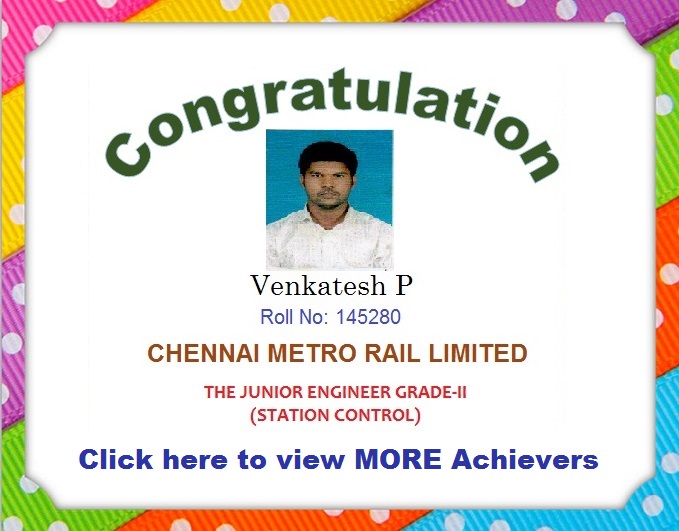
ACHIEVER GALLERY


Word of Mouth